Dear Esther is an experience rich in narrative allusions. Noticeable amongst these are its flashbacks to a fateful journey upon Britain’s motorway network. These maps, which were submitted by contributor Gemmy (originally, before I’d experienced the game for myself), highlight a rather curious selection of roads in Great Britain and Ireland.
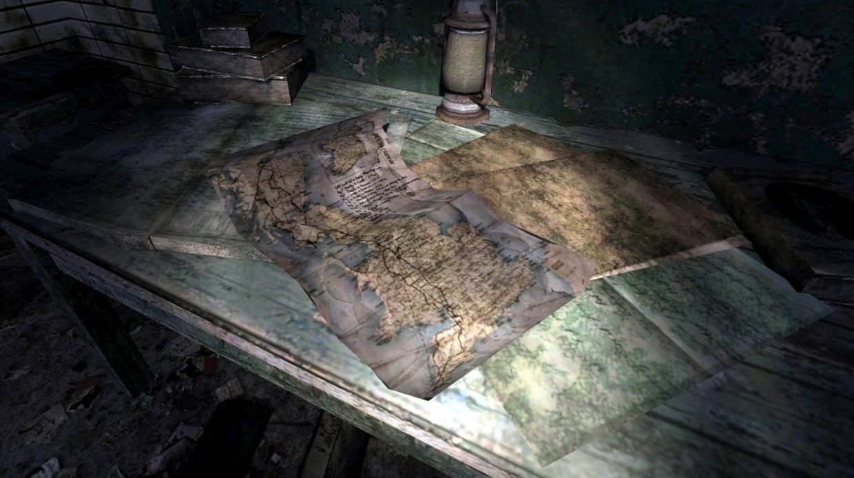
Included amongst this pile of degraded papers (or wallpaper?) and a presumed map of Europe is a water-damaged map of Great Britain and Ireland. Two bold tracks mark a route between Land’s End and John O’Groats. These tracks follow the major arteries of Britain’s road network, including:
- A-roads past Bodmin, Launceston and Bude;
- the M5 and M6 from Exeter to Carlisle via Birmingham;
- the A74(M) and assorted motorways in lowland Scotland, leading to A-roads through the Grampians;
- and an assortment of A-roads around Strathclyde, splitting off from Glasgow to take the highlands route via Fort William.
Given that we’re told of a car journey during letters read throughout Dear Esther, these maps contribute towards environmental storytelling to a rare degree.